Terrains
Although GenesisII will generate realistic looking surfaces automatically, geographic
users will want to control the details of the surface rendering directly. To
facilitate this GenesisII uses the concept of Terrains or Terrain
Layers.
Each terrain describes a set of characteristics that can be applied to the
landscape, for example surface color or vegetation. Terrains are mapped onto
a landscape surface as a series of polygons or lines. There is no limit on the
number of terrains that can be defined, or the number of polygons or lines for
each terrain. Using Plugin interfaces terrain data can
be imported into GenesisII from GIS packages such as MapInfo and ArcView.
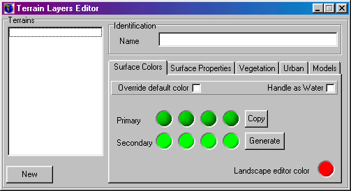
Terrain Layers Editor
Terrains
Terrain List Box: List the available terrains. Click New to
add a new terrain. Select a terrain to edit it's characteristics.
Identification
Name: An arbitrary name for the terrain. Duplicates are allowed,
but not recommended.
Colors
Defines the colors used for the terrain.
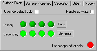
- Override defaults: If checked these colors are used, otherwise the
default colors defined by the fractalization editor
are used..
- Handle as Water: If checked this terrain area will be rendered as water. This option should be primarily used for rivers as areas of open water are better handled by flooding using the landscape editor.
- Copy: Copies the primary gradient to the secondary.
- Generate: Generates a standard set of colors for the terrain. A dialog
is displayed from which water colors (usually used for rivers) or land colors
(based on the first primary color) can be selected.
- Colors: Set gradient colors.
- Landscape Editor Color: Color polygon, line or model location is
drawn in the Landscape editor.
Surface Properties
Controls the material characteristics of the surface
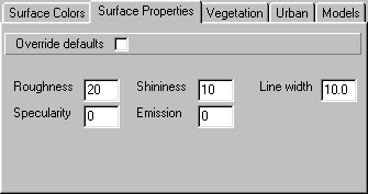
- Override defaults: If checked these properties are used, otherwise
the default surfaces defined by the fractalization editor
are used..
- Roughness: Surface roughness.
- Shininess: Shininess of the surface.
- Specularity: Highlight reflections.
- Emission: Emission characteristics.
- Line Width: Width polygon edges (if plants only drawn on edge) or
lines are drawn.
Vegetation
Terrain vegetation is described in a similar manner to that used
for Ecology. Up to four plants may be defined. Terrain
vegetation always overrides ecologically placed vegetation.
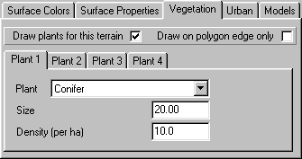
- Draw Plants: Check box to switch vegetation drawing on/off for this
terrain.
- Draw on polygon edge only: Only places vegetation around edge of
polygons - often used for hedges/fields on arable land.
- Plant Type: Drop down list of available plant type. Select one or
none.
- Size: Average size for the plant type. Some random variation will
added when drawing.
- Density: Average density for the plant type. Some random variation
will be added when drawing.
Urban
Controls drawing of Urban Plans. You can draw one urban plan on each
terrain layer, and these can be used in conjunction with vegetation.
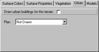
- Draw Urban Buildings for this terrain: Check box to switch urban
drawing on/off for this terrain.
- Plan: The Urban Plan to be used..
Model
Defines which 3D model this terrain will draw. For efficiency reasons
models must be defined in .g3s format, but a convertor is supplied to import
from 3D Studio Max .3ds format.
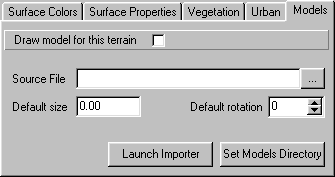
- Draw model for this terrain: Check box to switch model drawing on/off.
- Source File: Specifies the 3D source file for this model.
- Default Size: Default model height. Can be overridden in the Landscape
Editor
- Default Rotation: Default rotation value (clockwise from 0 - north).
Can be overridden in the Landscape Editor.
- Set Models Directory: Sets directory path for model source files.
- Launch Importer: Launches the 3DS to G3S format convertor.


